One island, two coastal settings
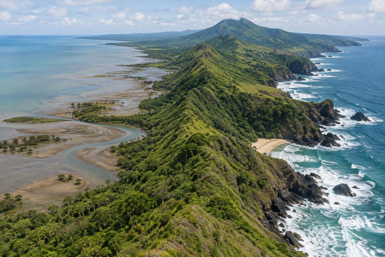
Look at a map of Java and the broad contrast is clear: its north coast faces the Java Sea, while its south coast faces the Indian Ocean. On the ground, that often means different views. Parts of the north are low, with muddy shallows, river mouths and fishing settlements. Many southern stretches meet stronger surf, with headlands, cliffs or beaches tucked between them. Neither coast follows a single pattern, but the contrast is a useful starting point for understanding the landscape.
A shoreline takes shape where land and water meet over time. Waves move sand and wear away exposed rock; rivers deliver mud and other sediment; the slope and structure of the land influence where that material settles. The sea a coast faces matters because it affects the energy reaching the shore. It does not, by itself, determine whether a particular beach will be sandy, rocky or muddy.
Why many northern shores are low and muddy
The Java Sea is relatively shallow and sheltered compared with the open ocean south of Java. In places where wave action is gentler, fine sediment carried by rivers can settle near the shore instead of being quickly swept away. Over time, this can help form broad, low-lying coastal ground, estuaries and tidal flats. Water that looks brown near a river mouth may simply be carrying suspended sediment; its colour alone does not tell the whole story of its condition.
These sheltered, sediment-rich settings can also support mangroves where local conditions allow. Their roots occupy the zone between land and water, offering habitat for coastal life and helping hold sediment in place. Yet northern shorelines are not fixed. Currents can shift material along the coast, and changes to rivers, land use or coastal structures can affect whether a stretch gains sediment or loses it. A muddy edge in one place may give way to a sandy beach, a built waterfront or an eroding bank a short distance away.
Why the south often feels more exposed
Java’s south coast faces the Indian Ocean, where swells can travel toward shore with considerable force. Waves breaking against exposed land can remove loose material and work on cracks in rock. Where headlands resist erosion better than nearby ground, they may stand out around smaller bays. Sand can collect inside those bays, creating the pocket beaches that give parts of the southern coast their striking shape.
The land behind the shore matters too. In parts of southern Java, hills and rock formations reach close to the sea, leaving less room for wide coastal plains. This helps explain why a viewpoint above a southern beach may look very different from a flat northern waterfront. It does not mean every southern beach has cliffs or powerful waves at all times: local shelter, seabed shape, tides and weather all affect what a visitor sees on a particular day.
Rivers and seasons complicate the picture
Rivers link inland Java to both coasts. After rain, they may carry more soil and other material toward the sea. At a river mouth, some of that load settles; some is moved alongshore by waves and currents. The balance helps shape sandbars, channels and beaches. A beach can look wider or narrower as sand shifts, even without an obvious change to the land behind it.
Conditions also vary through the year. Wind and rainfall patterns can change wave exposure and the amount of sediment reaching the coast. Tides reveal or cover mudflats and alter the space available on a beach. For that reason, a photograph captures a moment rather than a permanent shoreline. When comparing coastal places, notice the tide, the recent weather and whether a river enters the sea nearby.
How to read the coast as you travel
A simple way to explore either shore is to ask three questions: What is the land made of and how steep is it? Where can rivers bring sediment? How exposed is this spot to incoming waves? A broad mudflat near a northern estuary and a sandy cove below a southern headland have different answers, even though both are part of Java’s coastline. Looking for those clues makes the scenery more interesting without reducing either coast to a stereotype.
Let the conditions guide what you do, not just what you photograph. Soft mud and tidal channels can make a northern shore difficult to cross, while surf and currents can make a southern beach hazardous even when the sand looks inviting. Observe local access signs, check conditions before entering the water and keep a respectful distance from working waterfronts and fragile coastal vegetation. The most rewarding comparison may be the quieter one: noticing how land, rivers and sea keep shaping each place.