A landscape shaped by dissolving stone
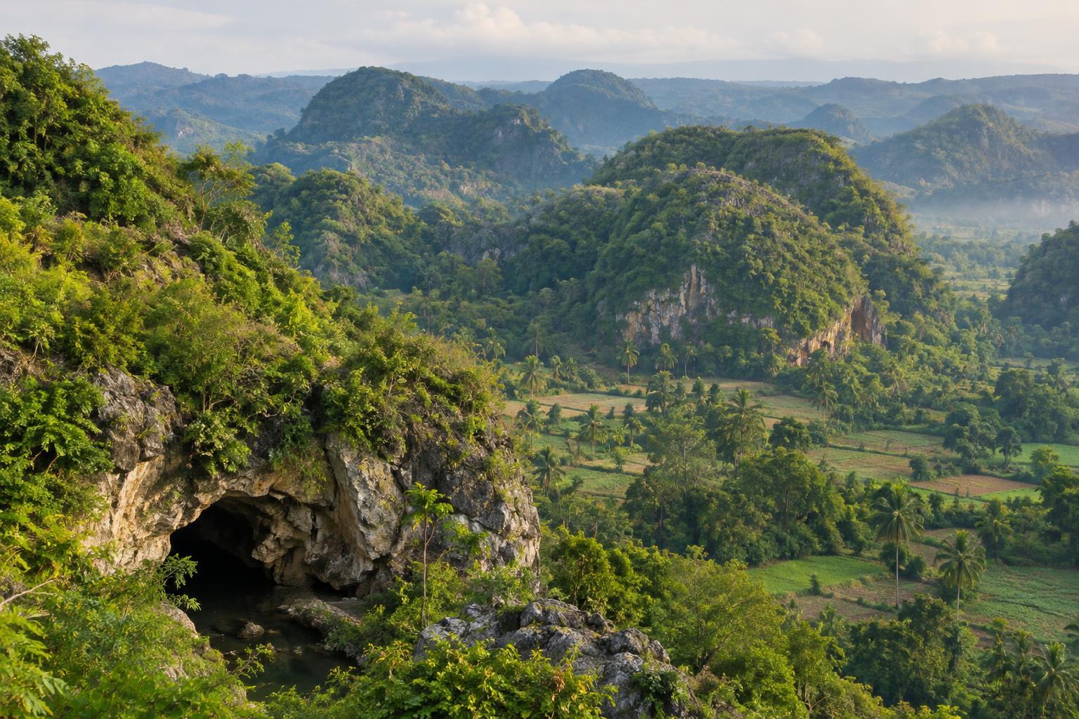
Gunungkidul, in the southeastern part of the Yogyakarta region, is known for rounded limestone hills, rocky valleys and caves. These features belong to a karst landscape: terrain formed where water gradually dissolves soluble rock. Rainwater picks up a little carbon dioxide as it passes through the air and soil. Over long periods, it can widen cracks in limestone into channels and chambers.
This process helps explain why a walk across the hills may reveal relatively few streams, even where water has carved extensive passages below. Small depressions can collect rain, while openings in the rock may carry it underground. Not every hollow is a cave, and not every cave contains a river, but the visible landforms offer clues to a connected system beneath the surface. The hills are best understood slowly, by noticing where water flows after rain and where it seems to disappear.
What the surface can tell you
Karst is more varied than a view of bare rock might suggest. Soil gathers in pockets and valleys, supporting fields, gardens and trees. Elsewhere, exposed limestone creates thin, stony ground. The contrast can be striking over a short distance: a cultivated plot may sit beside a dry-looking slope, with a cave entrance tucked into the hillside nearby.
Look for rounded ridges, enclosed low areas and rock faces marked by cracks. At some sites, springs emerge where underground water returns to the surface. Along the southern coast, limestone cliffs and coves show another side of the same geology, although the coast has also been shaped by waves. Observing these features from established paths is often more rewarding than trying to reach every opening or viewpoint. A landscape that looks open from afar can contain steep drops and fragile ground underfoot.
Caves and rivers below ground
As water follows fractures through limestone, it may create passages large enough to enter. Dripping water can also deposit minerals inside a cave, slowly forming features such as stalactites and stalagmites. These formations are easily damaged and take a long time to develop, so they are best viewed without touching them. Cave floors may be muddy, uneven or slippery even when the weather outside is clear.
Underground waterways are part of Gunungkidul’s appeal, but they require particular caution. Rainfall elsewhere in a drainage area can affect water levels inside a cave, sometimes before conditions at the entrance appear to change. Treat any cave involving water, ropes, steep descents or narrow passages as an activity that needs appropriate local guidance and equipment. If conditions are uncertain, choose a surface walk or an accessible cave route instead. There is no need to enter a difficult passage to appreciate the geology.
Planning a thoughtful visit
Start by deciding what kind of experience you want. A roadside viewpoint or short hill walk offers a broad sense of the terrain; a managed cave visit brings the rock formations closer; a longer outing can connect inland hills with the coast. Travel times between sites can be longer than a map suggests because routes wind through villages and hilly ground. Leaving room in the day for unplanned stops makes the journey more pleasant than trying to fit in too many caves.
For a cave visit, ask on site about the route, its physical demands, lighting, footwear and whether conditions are suitable that day. A small torch is useful even on a guided route, and shoes with reliable grip are preferable to smooth-soled footwear. Carry drinking water and sun protection for exposed walks. Rain can change both road and trail conditions, so keep plans flexible rather than treating an underground activity as essential.
Travel with care for the landscape and its communities
Karst is not just scenery. People live and farm among the hills, and water moving through the rock matters to everyday life. Stay on permitted routes, follow local instructions at cave entrances and avoid leaving litter where it could wash into a drainage opening. Do not remove rocks or cave formations, and avoid marking walls or disturbing animals sheltering inside.
A respectful visit also means allowing space for ordinary village activity. Keep noise low near homes and fields, ask before photographing people, and use designated parking where available. Gunungkidul’s most memorable lesson may be that its apparent dryness hides a complex movement of water. Taking time to read both the surface and the spaces below it reveals a landscape that is more connected—and more delicate—than it first appears.